|
|
|
|
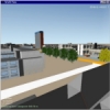
KARMA vI is an application for modelling, manipulation and analysis of two and three dimensional spatial (GIS) data within a Virtual Reality environment. 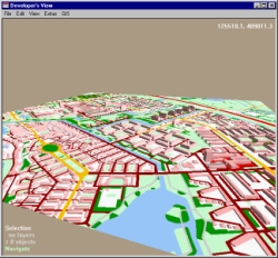 To adequately support visualisation and interaction with 2D and 3D spatial data, Virtual Reality (VR) techniques are used. KARMA supports stereoscopic viewing, 3D interaction devices and provides a 3D user interface for easy modelling and manipulation. The application runs on PC, but also on high-tech VR systems like a Virtual Workbench or CAVE. As one of its main features, KARMA can link spatial data, such as a 2D map or a TIN surface, to 3D models created in, for example, 3D Studio MAX. By combining these two information sources, you can realistically model and analyze future changes in the landscape. 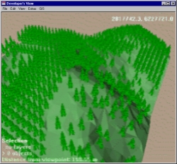 When combining different types of complex data, a special approach is required to ensure clear presentation of the data to a user. For example, a user might want to take a look at the 2D map of an area, move a newly planned road on that map, add a 3D model of a bridge, and view the road from a drivers' perspective to analyze the new situation. KARMA uses three different types of views to support these user actions. The views are based on the three design stages of the planning process of large infrastructure works in The Netherlands. 
Currently, KARMA version 1.0 is ready for professional use. You can contact us for more information. |
|
|