Technical Programme and Proceedings
ISBN 978-87-92853-48-6
ISSN 2311-8423

Proceedings 7th International FIG Workshop on 3D Cadastres, 11-13 October 2021, New York, USA (online), Editors: Eftychia Kalogianni, Alias Abdul Rahman and Peter van Oosterom. By clicking on the title of a paper in the draft programme you can view or download the corresponding PDF document. All times are local in New York City, EST.

Programme

 Opening - [video]


 Keynote
 Monday
 Anselm Haanen   [presentation]   [video]
 The Australia / New Zealand 3D Cadastral Survey Data Model and Exchange Project
 Keynote
 Tuesday
 Peter Buist   [presentation]
 Utilising current and new Galileo Services for 3D Surveys

 Monday 11 October 2021

 10:30 -
 12:10
 Section 1: 3D LA and BIM (Infrastructure, building) - Jesper Paasch - Session video recording
   Hanis Rashidan and Alias Abdul Rahman   [presentation]
 Converting BIM Data to CityGML for 3D Cadastre Purposes
   Marcin Karabin, Dimitrios Kitsakis, Mila Koeva, Gerhard Navratil, Jesper M. Paasch, Jenny Paulsson, Nikola Vucic, Karel Janecka and Anka Lisec   [presentation]
 3D Cadastre in the case of engineering objects, such as bridges and road viaducts
   Rohit Ramlakhan, Eftychia Kalogianni and Peter van Oosterom   [presentation]
 Modelling 3D underground legal spaces in 3D Land Administration Systems
   Marjan Broekhuizen, Eftychia Kalogianni and Peter van Oosterom   [presentation]
 BIM models as input for 3D Land Administration Systems for apartment registration
   Maria Gkeli and Chryssy Potsiou   [presentation]
 Linking LADM with BIM/IFC standards for mobile-based 3D Crowdsourced Cadastral Surveys
 14:45 -
 16:05
 Session 2: Future trends of 3D LA - Jacynthe Pouliot - Session video recording
   Nur An-Nisa Milyana, Bastiaan van Loenen, Willem Korthals Altes and Hendrik Ploeger   [presentation]
 4D Musrenbang: user experience (UX) to support public participation in spatial planning for Indonesia
   Abdullah Kara, Peter van Oosterom, Ruud Kathmann and Christiaan Lemmen   [presentation]
 Opportunities and Requirements for Web-Based 3D Visualization and Dissemination of Property Valuation Information
   Jesper M. Paasch and Jenny Paulsson   [presentation]
 New trends in 3D cadastre research - A literature survey
   Shen Ying, Hanrui Sun, Chengpeng Li, Wenting Zhang, Meng Wang, Yong Zhan, Yu Zhang and Xueye Chen   [presentation]
 Case-driven category analysis of 3D building property

 Tuesday 12 October 2021

 10:30 -
 12:10
 Section 3: 3D LA Country developments - I - Shen Ying - Session video recording
   Behnam Atazadeh, Hamed Olfat and Abbas Rajabifard   [presentation]
 3D Cadastre in Australian and New Zealand Jurisdictions: Similarities and Differences
   Jaroslaw Bydlosz, Artur Warchol, Monika Balawejder and Agnieszka Bieda   [presentation]
 Practical verification of Polish 3D cadastral model
   Sin-Yi Ho and Jung-Hong Hong   [presentation]
 Temporal perspective towards the design of cadastral systems in Taiwan
   Ksenia Khasanshina, Shimon Barazani and Yoav Tal   [presentation]
 Implementation of the 3D Cadastre in Israel - Stage 1
   Trias Aditya, Dany P. Laksono, Dedi Atunggal, Febrian F. Susanta, Nurrohmat Widjadjanti, Mohammad B. Setiawan, Nurhidayat Agam and Tri Wibisono   [presentation]
 3D Modelling, Validation and Visualization of 3D Parcels in First Registration for 3D Cadastre - Indonesia Case
 14:45 -
 16:30
 Section 4: BIM and GIS Integration (BIMGIS) - Mohsen Kalantari

 Wednesday 13 October 2021

 10:30 -
 12:10
 Section 5: 3D LA Country developments - II - Efi Dimopoulou - Session video recording
   Jernej Tekavec, Ema Pogorelcnik, Anja Krzan and Anka Lisec   [presentation]
 Towards 3D-Real Property Cadastre in Slovenia
   Aleksandra Radulovic, Dubravka Sladic, Miro Govedarica and Dusan Raicevic   [presentation]
 LADM based taxation model in Montenegro: Using BIM in taxation process
   Dedi Atunggal, Nurrohmat Widjajanti, Trias Aditya and Agus Wahyudi   [presentation]
 The Role of Positioning Infrastructure and Mapping Surveys in 3D Cadastre Implementation for Mass Rapid Transport Infrastructures - Indonesia Case
   Hicret Gursoy Surmeneli, Mila Koeva and Mehmet Alkan   [presentation]
 Integration of LADM and CityGML for 3D Cadastre of Turkey
   Grgo Dzelalija and Miodrag Roic   [presentation]
 Utilities Data in Land Administration Systems
 14:45 -
 16:25
 Session 6: Legal aspects of 3D LA - Miodrag Roic - Session video recording
   Saeid Emamgholian, Jacynthe Pouliot and Davood Shojaei   [presentation]
 3D Zoning: A Missing Piece to Link Planning Regulations with 3D Cadastre
   Morten D. Madsen, Jesper M. Paasch and Esben M. Sorensen   [presentation]
 Organization of rights and responsibilities in complex 3D real property developments - the relevance of bridging research fields
   Dimitrios Kitsakis, Eftychia Kalogianni, Efi Dimopoulou, Jaap Zevenbergen and Peter van Oosterom   [presentation]
 Modelling 3D legal spaces of Public Law Restrictions within the context of LADM revision
   Dionysia-Georgia Perperidou and Andreas Xydopoulos   [presentation]
 A 3D approach of Greece's Property Law on urban environmental pollution
   Jing Sun, Jesper Paasch, Jenny Paulsson, Vaino Tarandi and Lars Harrie   [presentation]
 Towards Design and Development of a BIM-based 3D Property Formation Process

 Closing - [presentation] - [video]


Remo on-line session links
Track A: keynotes (and 3D GeoInfo)
Track B: regular sessions 3D Cadastres


Keynote presentations
Monday 11 oct'21 16:45-17:30 ESTAnselm.JPGAnselm Haanen   The Australia / New Zealand 3D Cadastral Survey Data Model and Exchange Project
The '3D Cadastral Survey Data Model and Exchange' (3D CSDM) project aims to enable, as far as possible, a standard way of transferring cadastral survey datasets in all nine Australian states and territories and New Zealand. It aims to create a solution that will be supported by the survey software suppliers operating in the Australian and New Zealand market. It is intended to enable surveyors to progressively transition from lodging paper or PDF files to fully digital data. The project has two primary objectives:
  • To develop a harmonised data model that covers all cadastral survey data components required by the nine New Zealand and Australian cadastral agencies. This includes both 2D and 3D elements.
  • To identify, in liaison with survey software suppliers, options for encoding and exchanging the data in the model.
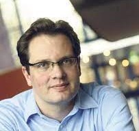
Anselm Haanen has been the Surveyor-General at Land Information New Zealand since 2018. He was previously the Deputy Surveyor-General. He holds a Master of Surveying degree from the University of Otago and has worked in various technical capacities since joining the department in 1978. He was heavily involved in the development of Landonline, New Zealand's automated survey and title system, and helped develop New Zealand's Cadastre 2034 strategy. He is the Sponsor of the 3D Cadastral Survey Data Model and Exchange project on behalf of the Australia New Zealand Intergovernmental Committee on Surveying and Mapping.
Tuesday 12 oct'21 12:45-13:30 ESTPeter.jpgPeter Buist   Utilising current and new Galileo Services for 3D Surveys
Status of Galileo: Galileo has made significant progress in recent years: twenty-six Galileo satellites are in-orbit, a significant part of the supporting ground station infrastructure has been deployed, the European Agency for the Space Programme (EUSPA) has assumed the role of the Galileo Service Provider, various new Galileo services are being tested, and the 2nd generation of the system is already under definition. To support Galileo's service phase, a service facility called the Galileo Reference Centre (GRC) was established. The centre plays an important role in the Galileo service provision as it permits EUSPA to independently monitor the performance of the services delivered to users, and serves as the door through which European Union (EU) Member States (MS) can contribute to these tasks. New Galileo Services: Galileo has recently started testing Open Service Navigation Message Authentication (OS-NMA) and High Accuracy Service (HAS) in the signal-in-space. Galileo's OS-NMA is an authentication protocol that allows GNSS receivers to verify the authenticity of part of the Galileo information, making sure that the navigation message they receive are indeed from Galileo and have not been modified in any way. Galileo's HAS will provide free of charge high accuracy PPP corrections in an open format for multi-constellation and frequencies through the Galileo signal (E6-B) and Internet. It will offer real-time improved user positioning performances with accuracy less than two decimetres at two service levels: one global and the other one over Europe. Other services are also under way. These include, for example, the Emergency Warning Service (EWS), where the Galileo's messaging function is used to transmit, in case of an emergency, an alert to user devices. The alert will contain specific instructions to follow, which depend on the area the user is located in. Galileo for Surveying: With Galileo's progress, new opportunities occur also for the surveying application: Galileo-only RTK with cm-level accuracy has been possible for some time (Galileo-only Cadastral boundary reconstruction of the GRC premises has been performed for the first time in July 2019) and the availability of the Galileo supported RTK solutions, benefitting from the high accuracy of its observables, will increase when more satellites become available. PPP solutions benefit, as well, in terms of convergence time, accuracy and robustness. The authentication features of Galileo's OS-NMA may prove to fill a gap in surveying; currently no generally accepted technology exists able to authenticate the position of the surveyor. With HAS, Galileo will pioneer free high-accuracy positioning service aimed at applications including 3D surveys that require higher performance than that offered by OS.
  Peter Buist is at the EUSPA, responsible for the GRC. He worked in the aerospace industry, the academia and governmental organisations in Europe and Japan, specializing in GNSS. He holds both Masters and PhD degrees from the Delft University of Technology. At the GRC, he is managing the inhouse developments, contributions from contractors and EU Member States and Norway/ Switzerland (currently 24 organisations form 14 different countries).
Top Top